
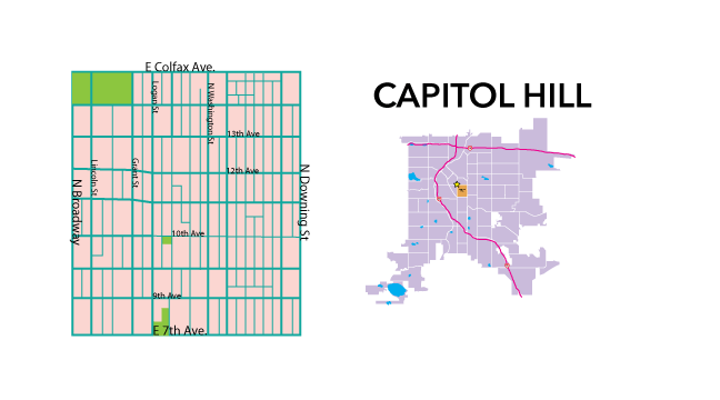
Neighborhood Profile: Capitol Hill
Capitol Hill History:
In 1867 Denver was designated the official territorial capitol. At the time most of Denver’s growth had been towards the northwest, close to the South Platte River. The building of the Tabor Grand Opera House and the donation of land for the sight of the state capitol, from Henry C. Brown, changed the growth of the city’s business district towards the east.

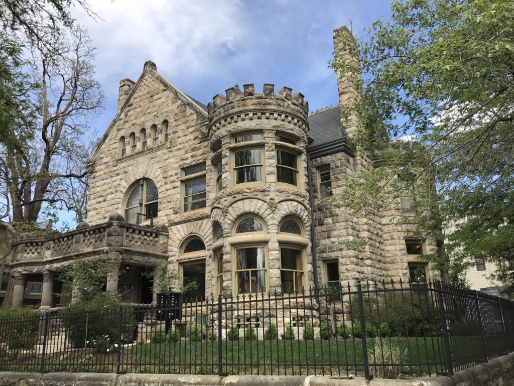
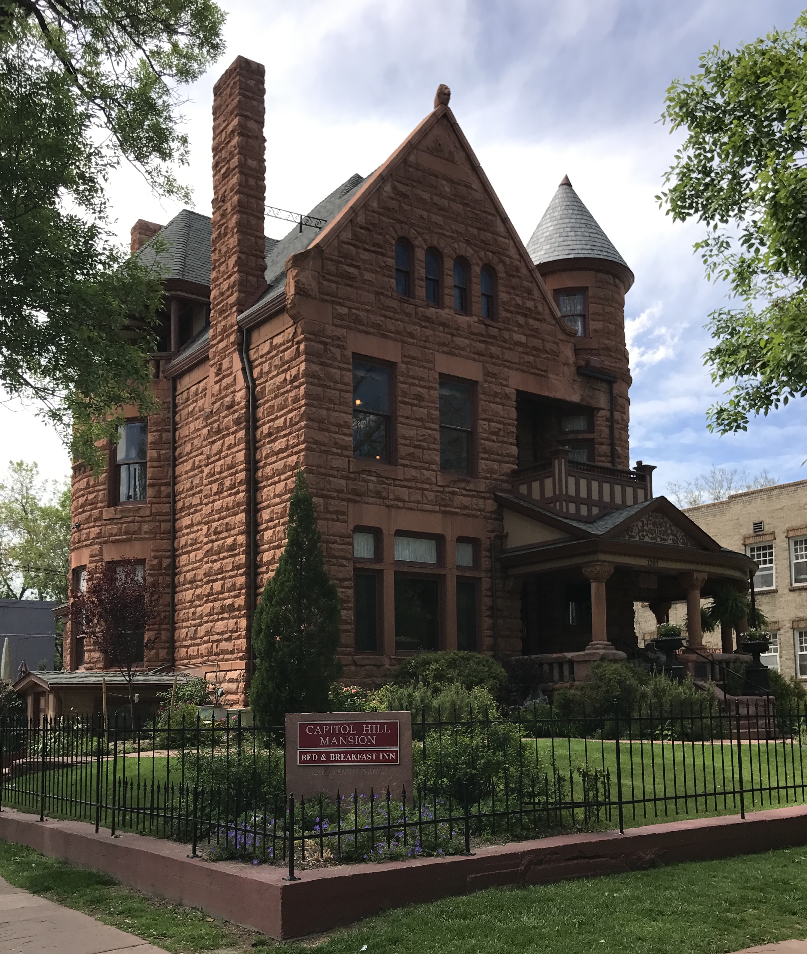
By the late 19th century most of Denver’s wealthy had moved to Capitol Hill. Their mansions were done in an array of styles including: Tudors, Victorians and early Greek Revivals. In the early 1900’s, as the city grew, the wealthy moved further south towards the Cheeseman Park and Country Club neighborhoods. This growth changed the landscape of the neighborhood. East Colfax (formerly a residential street) was zoned for businesses. Beautiful homes and apartment buildings were demolished or reconstructed to comply with theses new codes.
According to The Piton Foundation, “During World War II, Capitol Hill provided rooms and apartments to people who could not find housing elsewhere. These non-conforming apartments were formally recognized in 1955 with overall high density residential (R-3) zoning of the neighborhood. This zoning spelled the beginning of the end of Capitol Hill as a well-balanced single-family home and apartment district. Inflated real estate values caused by the neighborhood’s central location and proximity to down- town accelerated this trend.”
Capitol Hill Today:
Capitol Hill is an incredibly sought after neighborhood. The population density is the highest in the city. Just a walk away from an abundant amount of restaurants, entertainment and museums. There is still a great amount of early 20th century homes that have been converted to apartments.
Where:
Capitol Hill is bounded by East Colfax Avenue to the north, East 7th Avenue to the south, N. Broadway to the west, and N. Downing Street to the east.
Who Lives There:
A majority of the population is single (66%), married couples comprise 16%, and only 3% of households have children.
Retail Areas:
East Colfax Avenue
Broadway
East 11th Avenue
East 13th Avenue
Median Sales Price:
$264,000 for a single family home (2017), $775,000 (detached single family residence), $254,000 (condo)
Main Attractions:
Close to museums, shopping, dining, and the Capitol building; many historic homes and apartment buildings
Common Complaints:
Busy road with lots of traffic, finding parking can be very difficult, 80% of the residents are renters
Schools:
Dora Moore
Morning Star Preschool and Daycare
Art Intitute of Colorado
Local Parks:
Govenors Park
Colorado State Capitol Grounds
Quality Hill Park
Public Transportation and Bike Lanes:
Bus lines that service the area are the 6, 0, 83D, 83L, 15, 10, 16, 12, oL, 3L, 83, 87L, 100L, 116X, CS, CV, CX, ES, EV, EX, and P.
Shared lane bike routes include the D10 (E. 12th Ave.), D9 (Sherman St.), D12 (E. 7th Ave.), and D-11A (Ogden St.)
The neighborhood has multiple B-Cycle Stations
Art Venues, Places of Interset and Annual Events:
Molly Brown House Museum
Boettcher Mansion
Malo Mansion
Grant- Humphrey’s Mansion
History of Colorado Center
“Capitol Hill Neighborhood History”
Denver Public Library: Neighborhood History Guides
http://history.denverlibrary.org/capitol-hill-neighborhood-history
Web.5/2017
“Capitol Hill”
Community Facts: Neighborhood Summaries
http://denvermetrodata.org/neighborhood/capitol-hill
Copyright 1998, The Piton Foundation. Web.5/2017.
Statistical data collected from Metrolist, Inc. RE Colorado – powered by Matrix.